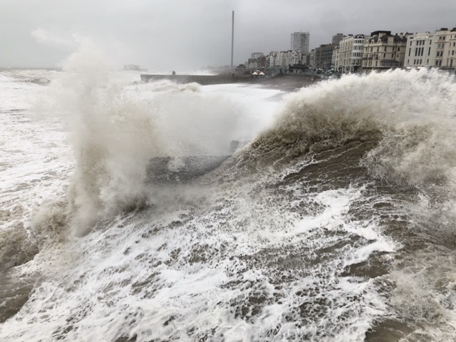
A three day long weather warning has been issued, with wind and rain forecast to bring a weekend washout.
Although the Met Office hasn’t yet named the stormy weather set to hit the south coast this weekend, it will be dubbed Storm Darragh if it does become a named storm.
And with winds of up to 80mph and as much as 3in or 7cm of rain, this is a distinct possibility.
The warning, issued this morning, is in place from 3pm on Friday (6 December) until 6am on Sunday and covers all of England and Wales.
It says: “A deep low may cross England and Wales from Friday afternoon, clearing to the east Saturday night.
“The low may bring a period of strong winds to much of the warning area, with some heavy rain likely to the north and west of the low centre, and some hill snow in the north (above about 200 metres).
“Around 15mm to 25mm of rain may fall quite widely, more particularly across central, northern and western parts of England and Wales, with exposed higher ground in the north and west (particularly parts of Wales, which are at greatest risk of seeing flooding impacts) perhaps locally seeing closer to 50mm to 70mm.
“Winds may quite widely gust to around 40mph to 50mph inland but locally could gust in excess of 60mph while, around coasts, winds may gust to 60mph to 70mph, perhaps locally nearer 80mph.
“The wind and rain may cause disruption to travel, with difficult driving conditions likely.”


This is getting a bit silly now, naming just about every area of low pressure as a storm? Scaremongering at it’s finest. Just a way of over hyping a very wet & windy bit of weather!
I’m not sure it helps giving the storm a name, but the idea is that people get to hear about it.
As someone who lives just off Hove seafront, and in a wind tunnel, I’m glad to know when windy weather is on the way. The devil is then in the detail – and it’s the wind direction and likely gusts I look at, because in southerly winds my roof is at risk.
Seafront businesses also look at these forecasts in detail, and some have already decided to close this weekend – although the wind will be northerly by Sunday, and our seafront is mostly sheltered from that wind direction. From the current predictions, I’d say the storm will be worst for us on Friday night and for the first part of Saturday.
The key thing about ‘storm Darragh’ is that it’s a small low that tracks over us, meaning the wind starts as a southerly, but clocks round to a northerly by Saturday afternoon. But the nature of a small low means that the timing and wind direction details might yet change.
If you’re heading to a city centre pub on Friday night then you’ll notice the strong wind from about 8pm onwards, and overnight gusts of up to 63mph are predicted.
The southerly wind direction means this wind impacts all the pub and clubs on the lower promenade. Large waves then bring additional danger, all along the beach.
The swell size for Saturday is expected to reach over 4metres, creating a very dangerous shore break along the beach – especially in the run up to high water, which is at about 3pm.
Luckily, we go into neap tides this weekend so, with a relatively modest high tide, that should reduce the chances of seafront flooding.
Localised flooding is however possible inland, with Saturday’s rain expected to be heavy at times.
Storms only get a name if they meet strict meteorological criteria. So not every area of low gets named.
Storms get named when it’s predicted that the weather they will generate will be severe and prolonged.
Being given a name is designed to make the public more aware of possible danger.