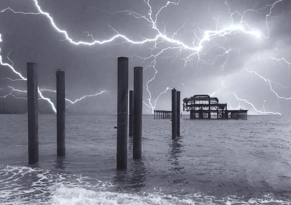
The Met Office has issued a thunderstorm warning for Brighton and Hove and the surrounding area.
Thunder, lightning and heavy rain have been forecast between midnight and 3pm today (Thursday 25 August).
The official forecaster issued the “yellow” warning for much of eastern and southern England as it revealed that August was on track to be another dry month.
The Met Office said that driving conditions could be affected by spray, standing water and even hail and there may be delays to train services, power cuts, flooding and lightning strikes.
The forecast rain as well as the downpours last week make it unlikely that this summer – June, July and August – will set a record for dryness.
But experts warned that there would need to be a period of above-average rainfall to ease the drought.
So far this month Britain as a whole has had only 46 per cent of the average total rainfall for August, the Met Office said.
Much of the country has seen even drier conditions, with only 35 per cent of the total expected rainfall for the month so far in England, 34 per cent in Wales and 39 per cent in Northern Ireland.
And in southern England there has been just 29 per cent of the month’s average from 1991 to 2020.
Bedfordshire has had only 13 per cent of its average August rainfall so far, recording less than third of an inch – or just 7.7mm – this month.
The continuing dry weather has led to a drought being declared across swathes of England, with parched grass and struggling crops, streams drying up and river, reservoir and aquifer levels low, and hosepipe bans brought in for millions as heatwaves pushed up demand for water.
Heavy rain is expected for some areas of the country today and tomorrow , with more than half an inch – or 15mm – in parts of the south east over three hours.
The Environment Agency issued six alerts for areas where “flooding is possible” today, adding: “Heavy rain and thunderstorms, bringing the potential for locally intense rainfall, are forecast to affect the London area.
“While uncertainty remains around exact timings and which areas will experience the heaviest rain, there is a possibility that rivers could respond quickly and overtop their banks.
“Flooding to low-lying land, roads and riverside gardens is possible. Surface water flooding may also affect low-lying areas.”
But the bank holiday is expected to be largely dry with warm sunny spells, with temperatures climbing to 30C or into the mid-20s depending on how the high pressure builds, the Met Office said.
Grahame Madge, from the Met Office, said: “We’ve definitely switched from the hot and dry regime to something that has rain in the forecast.
“There’s some heavy rain for the next 24 to 36 hours, providing some relief to gardeners more than helping to top up long-term resources.”
While the forecast rain for this week will mean this month will “catch up a bit” with rainfall totals, he said: “It’s certainly going to be a dry August for the whole of the UK.”
And he said that some areas had gone without any significant rainfall from the middle of June until last week, adding: “We’ve had below-average rainfall for such a long time, it’s going to take a period of above-average rain to make it up.”
Whether that period of above-average rainfall is looming remains to be seen, with the Met Office set to bring out its seasonal forecast for the likely conditions over the next few months next week.
It is possible for the weather to turn around: the severely dry summer of 1976 was followed by rain that meant that rainfall levels had caught up with the average by the end of autumn.
But scientists said that climate change was making weather extremes more likely, increasing heatwaves, droughts and heavy rain events that can lead to flash floods.


