Storm Abigail might have brought us unseasonable warmth – but Storm Barney, the second ever named UK storm – is set to bring more disruptive weather.

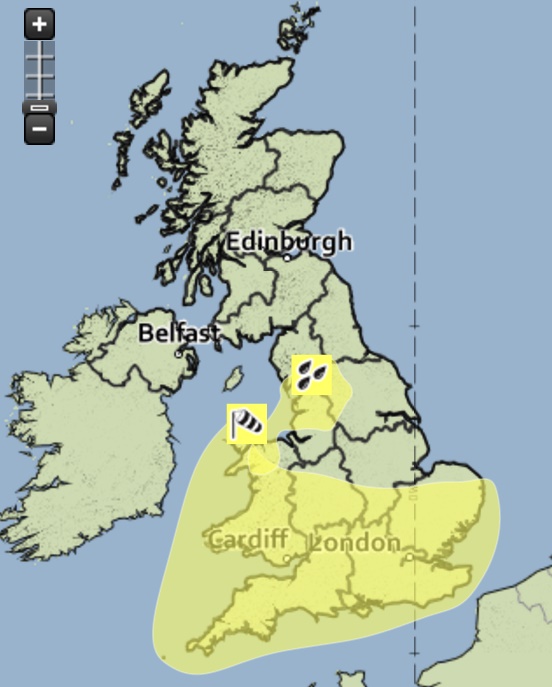
The Met Office has issued a yellow be aware severe weather warning for tomorrow from 3pm to 11.30pm, as severe gales are likely to sweep eastwards across the south of England.
Gusts are forecast to reach 60-70mph inland and possibly 80mph along exposed coasts, particularly Wales and through the Bristol Channel.
It says the public should be aware of the risk of disruption to travel, and that gusts of this strength could bring down trees and lead to some damage to weakened structures.
The Met Office’s chief forecaster said: “A deepening area of low pressure is likely to track east across southern Ireland and then central parts of the UK during Tuesday afternoon and evening, with a swathe of very strong winds potentially developing on the southern flank of the low.
“At this stage, the worst of the winds are expected to reach West Wales mid to late afternoon, sweeping rapidly eastwards during the evening.
“There remains a good deal of uncertainty in this evolution and particularly the location of the strongest winds, so this warning will be kept under review and updated as necessary.”


